Merchandise sales locations will be closed state-wide for the required annual inventory beginning Wednesday, April 15 and will reopen when completed on April 16.
Open fires are prohibited throughout the park from midnight to 4 p.m., Feb. 15 through April 30. Learn more.
Shot Tower State Park
116 Orphanage Dr., Max Meadows, VA 24360; Phone: 276-699-6778; Email: newrivertrail@dcr.virginia.gov
Latitude, 36.8684. Longitude, -80.8723.


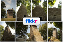
Photos and video
This content takes priority over any other information provided on this park's webpage.
Shot Tower grounds are open from dawn to dusk.
Tours are unavailable due to renovations. Standard parking fee applies.
Please review the Virginia State Parks Know Before You Go information before you visit.
General Information
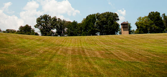
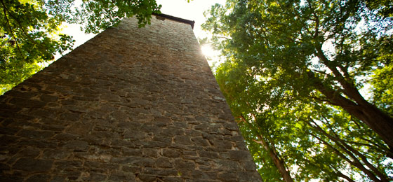
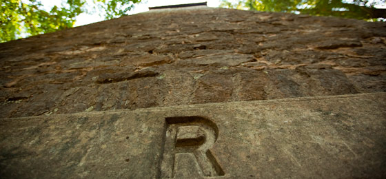
Overlooking the New River, Shot Tower was built more than 200 years ago to make ammunition for the firearms of the early settlers. Lead from the nearby Austinville Mines was melted in a kettle atop the 75-foot tower and poured through a sieve, falling through the tower and an additional 75-foot shaft beneath the tower into a kettle of water. Guests may ascend the tower, which is on the National Register of Historic Places. Interpretive signs provide details on the tower. Grounds are open from dawn until dusk. The parking lot is open year-round. The tower is open on scheduled days in the summer. Admission to the tower is free, however the daily parking fee applies. Group tours are also available. Call the office at 276-699-6778 for details.
Click here for a brochure about the Shot Tower.
Hours
The grounds are open from Dawn to dusk.
Location
From I-77, take exit 24 and go north on Route 52 for two miles.
Drive Time: Northern Virginia, six and a half hours; Richmond, five hours; Tidewater/Norfolk/Virginia Beach: seven and a half hours; Roanoke, one and a half hours
Park Size
10 acres.
Cabins, camping
OVERNIGHT FACILITIES
None - day use only, but see New River Trail State Park for overnight camping facilities near this park. For information on availability of other parks' overnight accommodations, particular park amenities or to make a reservation, you can reserve online or call 1-800-933-PARK. Click here for park fees.
Camping
Primitive camping is available about .2 miles along New River Trail. Call 800-933-7275 to make reservations.
Recreation
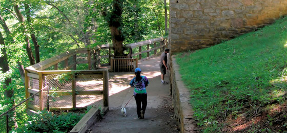
TRAILS
Hiking at New River Trail State Park.
SWIMMING
None at this park.
FISHING, BOATING
None at the tower, but boat access and rentals are available at New River Trail State Park.
HORSES
The closest parking available for horse trailers is The Mark E. Hufeisen Day Use Area about .2 miles from the tower. State law requires that visitors carry a copy of a negative Coggins report with each horse brought to the park.
Park Trail Guide
Click here for the park's trail guide.
Nearby Attractions
Pulaski County
- Pulaski County Chamber of Commerce
- Claytor Lake State Park
- Gatewood Park
- Jefferson National Forest
- Motor Mile Speedway
- Wilderness Road Regional Museum
- Randolph Park
- The New River Valley Fairgrounds has many events and activities year-round.
Wythe County
- Wythe County Chamber of Commerce
- Wohlfahrt Haus Dinner Theatre
- Wolf Creek Indian Village and Museum (Bland, VA 42 minute drive)
- Hungry Mother State Park is within an hour's drive.
- Wytheville Training School
Carroll County
- Twin County Regional Chamber of Commerce
- Blue Ridge Parkway
- Beaver Dam Creek Trail
- Blue Ridge Country Club
- Carter Pines Community Park
- Crooked Creek Wildlife Management Area.
Galax
- The city of Galax
- Take an art, craft or music class at the Chestnut Creek School of the Arts
- Barr’s Fiddle Shop
- Blue Ridge Music Center
- Old Fiddler’s Convention
- Galax Recreation Center
- The Crooked Road
Grayson County
- Visit Grayson County
- Grayson Highlands State Park
- Mount Rogers National Recreation Area
- Matthews Living History Farm Museum
- Town of Fries
Itineraries
Picnic Shelters
Picnic tables and restrooms available.
Meeting Space and Facilities
MEETING FACILITIES
None at this park.
VISITOR CENTER, GIFT SHOP
None at the tower, but you'll find them in Foster Falls, about .2 miles away.
RESTAURANT
None at this park.
LAUNDRY
None at this park.
ENVIRONMENTAL EDUCATION CENTER
None at this park.
SPECIAL FEATURES
The historic tower and access to New River Trail.
Other Info
ACCESSIBILITY
Shot Tower grounds and restrooms are accessible. The Shot Tower is not accessible, however photos of the tower and views are on display.
NATURE, HISTORY PROGRAMS
Shot Tower's history. Click here to view all parks' events, festivals, workshops and interpretive programs.
CONCESSIONS
None at the tower, but the boat and bike livery and the depot gift shop are available .2 miles away at New River Trail State Park's Foster Falls village.
HISTORY
Overlooking the New River, Shot Tower was built more than 200 years ago to make ammunition for the firearms of the early settlers. Lead from the nearby Austinville Mines was melted in a kettle atop the 75-foot tower and poured through a sieve, falling through the tower and an additional 75-foot shaft beneath the tower into a kettle of water. Guests may ascend the tower, which is on the National Register of Historic Places. Interpretive signs provide details on the tower.
FRIENDS GROUP
None.
Events, Programs
- 04/11/2026 - N&W Caboose Tour
- 04/11/2026 - Walk With A Ranger
- 04/11/2026 - Intro to Geocaching
- 04/12/2026 - Wild Plants of SWVA Walk
- 04/14/2026 - Driving Through History: Van Tour of the New River Trail (North End)
- More events at this park.

At a Glance


