Due to the expected impact of the winter storm, all Virginia State Park overnight facilities will be closed from Friday, Jan. 23 through Tuesday, Jan. 27. This decision is based on the forecast for unsafe conditions and potential power outages. For updates click here.

Read Our Blogs
A Day in the Life of York River State Park: Backbone Trail
So, you have a couple of hours to explore the great outdoors on foot at York River State Park. Along the way, you find adventure and inspiration around every bend. First you may discover the lost historical locations of slave quarters, blacksmith’s and wheel wright’s shops, well then, you must be on Backbone Trail.
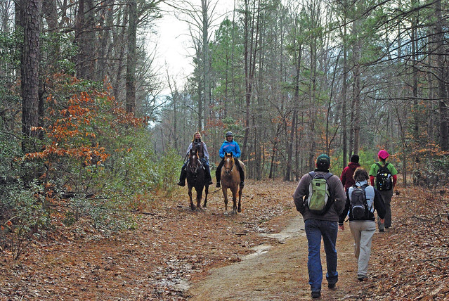
Happily sharing the trail
A little further along there are trailheads to several other paths that you can’t wait to check out on your next visit. But throughout the trek, mountain bikers pedal by to their specific trails such as Marl Ravine. An equestrian you pass lets you pet her horse as you make conversation. Almost all of the cross rib paths in York River State Park connect to this one, Backbone Trail.

Almost all trails lead to Backbone
The Skinny
Backbone Trail is a 2.5 mile in-and-out trail that starts at the Contact Station and ends at Riverview Road. After the hill between the intersections with Beaver and Woodstock Pond, the trail has no significant hills.
Except for Taskinas Creek, every trail connects directly or indirectly to Backbone.

Bikers and trekkers out enjoying the trail
To The Great Beyond
Most park guests do not explore Backbone Trail beyond the intersection with Woodstock Pond as part of a loop hike. But, for hikers with time on their hands, going past this point opens up a deeper costal woodland experience. There is even a picnic table and kiosk at the intersection with Whitetail Trail; making it a fine location of an outdoor lunch.
Our staff archaeologist, Jerry Traver, has identified sites of former slave cabins, a wheelwright’s shop, and a blacksmith’s shop dating back to the Taskinas Plantation era.
More history can be found on the Spur Trail while those who crave the marshes and shoreline can branch off to Pamunkey, Powhatan Fork East, and Riverview.

Bring your whole gang
Adventure Venue for All
As an old farm/plantation road, Backbone is wide enough so that horseback riders, mountain bikers, and hikers have plenty of room to avoid and meet each other. Of course, some horses can be a bit shy around other people and spooked by speeding bikes. Meh-Te-Kos Bridle Trail is practically right beside Backbone.
It is possible for bikers to ride Laurel Glen to Black Bear and Bobcat Run and the length of John Blair Trail and not see anyone on foot. However, as paths cross, one may be inspired to bring a bike next time; perhaps even a horse.
If you have friends with bikes and horses, why not make it a group adventure and switch off?
Ranger’s Recommendations
Chances are that you’d want to make Backbone a part of a full day’s hike. So, think ahead of where else you’d like to hike and come back again and again for other treks. The hard dirt trail is friendly for most all types of bicycles as are the other multi-purpose trails.
Those who have limited mobility can still enjoy much of Backbone by taking part in one of our Past Plantations Tours. Archeologist/Ranger Jerry will be on hand to describe life here during the colonial period. Take plenty of water and a high energy snack for the day.
Dogs on a leash are always welcome on Backbone Trail.

Take breaks and hydrate
Directions to York River State Park: From I-64, take the Croaker Exit 231B. Go north on Route 607 (Croaker Rd.) for one mile, then right on Route 606 (Riverview Rd.) about one and a half miles to the park entrance. Take a left turn into the park.
Editor's note: Click here for Ranger John's blog about the Woodstock Pond Trail, and here for Mattaponi Trail at York River State Park. If you are interested in learning more about the other outdoor recreational opportunities like fishing and boating, click here.


If you have read the article and have a question, please email nancy.heltman@dcr.virginia.gov.
Search for blogs
By Park
Categories
Cabins
Camping
Fishing
History and Culture
Other
Programs and Events
Trails
Volunteers
Water Fun
Archive
2026
2025
2024
2023
2022
2021
2020
2019
2018
2017
2016
2015
2014
2012


