
Read Our Blogs
A Day in the Life of York River State Park: Our Slice of the River
Travelers between metro Richmond and Tidewater have found our stretch of the York River to be a great place to explore the environment and history.
York River State Park is just about ten miles downriver from West Point and 20 from the Chesapeake Bay. We are also less than 10 minutes away from Virginia's Historic Triangle of Jamestown, Williamsburg, and Yorktown.
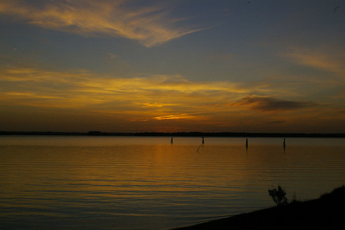
The morning hours are gorgeous on the York River
The four miles of our river shoreline is full of surprises
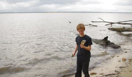
Anglers frequently catch blue and channel catfish along with Atlantic croaker and spot. The brackish water is able to support both fresh and saltwater species. During a full moon, the low tides expose a sandbar at the confluence of the river and Taskinas Creek and a very long mud flat along the seining beach. With our seining programs, the eyes of adults and kids light up as we discover the various fish and crabs that make their home in the river. Fossil hunters find relics from the pre-Ice Age world at fossil beach.
The cliffs make a great backdrop for river and land adventures
Our section of the York is an artery of history as well
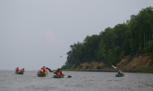
Across river is Wererocommico, the former village where Chief Powhatan once ruled some two dozen tribes of the Powhatan Confederacy. British, Colonial, Confederate, and Union forces have been in these waters during the Revolutionary and Civil Wars. A fort was near a bluff overlooking the river during Bacon's Rebellion. A replica of it is not far from the remains of the plantation seat of Constitution signer John Blair. At low tide, the remains of an old "corduroy road" can be seen from the canoe/kayak launch. These roads made it possible to bring goods into the marshes and loaded on small boats to load on ships without sinking into the mud.
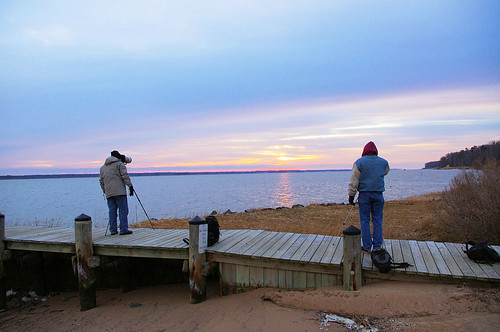
Photographers enjoy the York at Croaker Landing
Our river provides a quiet spot with great vistas and a good place to slow down and relax
Taking a seat at the Maritime Overlook, you may see a bald eagle or two snatching white perch from the water. We probably have the only view of the mouth of the Poropotank River, a tributary that separates King & Queen and Gloucester counties. With colder temperatures coming, rafts of waterfowl can be seen from Croaker Landing to Riverview.
Make discoveries along the York River all year long
Directions to York River State Park: From I-64, take the Croaker Exit 231B. Go north on Route 607 (Croaker Rd.) for one mile, then right on Route 606 (Riverview Rd.) about one and a half miles to the park entrance. Take a left turn into the park.
We invite you to visit York River State Park this winter to be find respite from the holiday busyness and find inspiration on our slice of the shoreline.


If you have read the article and have a question, please email nancy.heltman@dcr.virginia.gov.
Search for blogs
By Park
Categories
Cabins
Camping
Fishing
History and Culture
Other
Programs and Events
Trails
Volunteers
Water Fun
Archive
2024
2023
2022
2021
2020
2019
2018
2017
2016
2015
2014
2012


