
Read Our Blogs
Fall Road Trip to Virginia State Parks and Historic Covered Bridges
Posted September 27, 2014 | Updated September 28, 2018
There really is no place like Virginia in the fall. It's said we have more variety of leafy trees here than anywhere else in the country, which makes our state pop with color come end of September through early November.
If you enjoy road trips, then it's time to plan your fall getaway to a Virginia State Park and a side trip to a Virginia Historic Covered Bridge. We hope the following list of scenic bridges provided by the Virginia Department of Transportation (VDOT) will help enhance your fall fun.
Follow us to see the fall leaves at Virginia State Parks and nearby Historic Covered Bridges
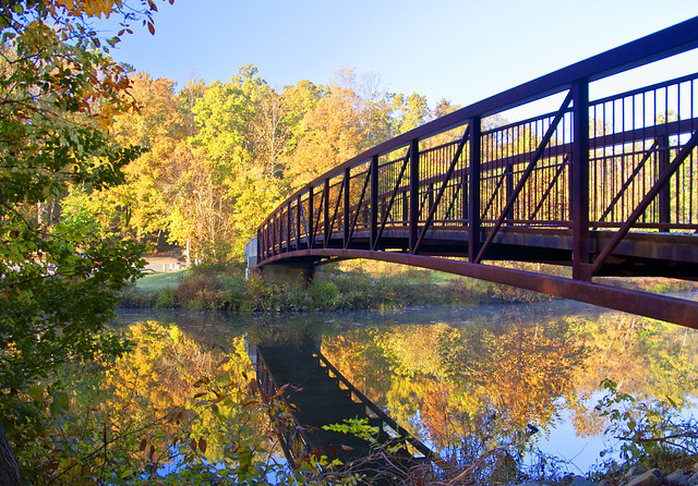
Footbridge over Swift Creek at Pocahontas State Park
From the mountains to the seashore the commonwealth of Virginia puts on a flashy show in the fall. With fall on our doorstep, now is the time to plan your getaway to a beautiful Virginia State Park, and as an added bonus a picturesque drive to a charming historic covered bridge. For you leaf peepers you know what I mean, as the nights get cooler you are getting more antsy to hit the road. So pack up the car, your picnic gear, a cozy sweater and hid the winding road.
COVERED BRIDGES
Historic covered bridges (also known as kissing bridges) make a fun side trip for a romantic photo opportunity, or to plant a kiss when you visit a Virginia State Park. Although none of the covered bridges are located inside a Virginia State Park, they make for great day trips when you stay in a park cabin or campground.
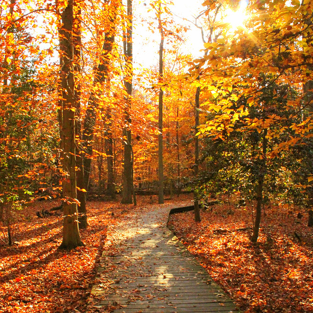
Autumn leaves adorn a state park trail
When you visit Fairy Stone State Park or Claytor Lake State Park, we recommend a day trip to see the following historic covered bridges this fall:
Jack's Creek Bridge crosses the Smith River in Patrick County on Route 615 just west of Route 8, about two miles south of Woolwine. The 48-foot span, built in 1914, has been replaced by a modern bridge but is being retained.
Directions: Jack's Creek Bridge can be seen from Route 8 at its intersection with Route 615, or it can be reached by turning west two-tenths of a mile on Route 615.
Bob White Bridge (1921), Smith River in Patrick County (Edited: we're sorry to report this bridge washed away Sept. 29, 2015) The Bob White Bridge in Patrick County is an 80-foot truss over the Smith River near Route 8, south of Woolwine. Built in 1921, it served principally as a connection between Route 8 and a church on the south side of the river. Although it has been replaced with a modern bridge, visitors can still walk up to the Bob White Bridge, which was retained for its historic value.
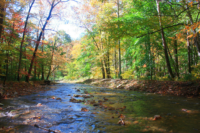
Beautiful Wilson Creek at Douthat State Park
When you visit Douthat State Park we recommend a day trip to see the following historic covered bridges this fall:
The venerable Humpback Bridge lays claim to being the oldest of Virginia's remaining covered bridges. Located in Alleghany County, just west of Covington, it was built in 1857. It was part of the James River and Kanawha Turnpike and succeeds three other bridges at the site. It stretches over Dunlap Creek, a tributary of the Jackson River that joins the Cowpasture River near Iron Gate to form the James River. The first structure was built in the 1820s and was washed away by a flood on May 12, 1837. The second fell victim to the flood of July 13, 1842. The third, as the annual report of the turnpike company put it, "gave way" in 1856. The 100-foot-long, single-span structure is four feet higher at its center than it is at either end, thus the name, "Humpback". Traffic across the bridge ceased in 1929 when it was replaced with a "modern" steel truss bridge.
Directions: Humpback Bridge can be reached from Interstate 64 by taking exit 10 to Route 60 and traveling one-half mile east, or by taking Route 60 west from Covington.
Sinking Creek Bridge (circa 1916), Sinking Creek in Giles County
The Sinking Creek Bridge (also known as Clover Hollow Bridge), a 70-foot span currently maintained by Giles County, was left in place for the property owner when a new bridge was built in 1949. It was built circa 1916 with modified Howe trusses.
Directions: The bridge is located just off Route 601 between Route 42 and Route 700, north of Route 460.
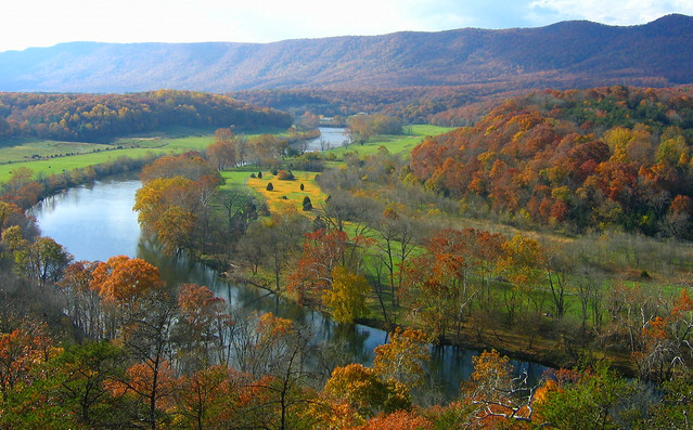
Culler's overlook at Shenandoah River State Park
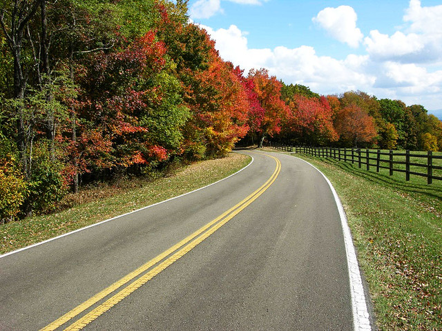
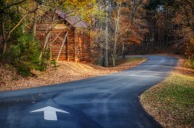
Follow this scenic fall road into Grayson Highlands State Park
When you visit Shenandoah River State Park or Sky Meadows State Park we recommend a day trip to see the following historic covered bridge this fall:
Meem's Bottom Bridge (1894), North Fork of the Shenandoah River in Shenandoah County.
One of the best-known covered bridges is the 204-foot single-span Burr arch truss known as Meem's Bottom in Shenandoah County. Here it’s possible to step back into the past, while less than a half-mile away the hum of modern-day traffic can be heard on Interstate 81. The site takes its name from the Meem family that owned large landholdings in the area. This long span over the North Fork of the river carried traffic for more than 80 years before being burned by vandals on Halloween in 1976.
After salvaging the original timbers, the bridge was reconstructed and eventually undergirded with steel beams and concrete piers.
Succeeding several earlier bridges, the Meem's Bottom Bridge was built in 1894. Materials were cut and quarried nearby for the massive arch supports and stone abutments, which extend 10 feet below the riverbed. Previous bridges in this spot were washed away in the floods of 1870 and 1877. The next bridge, built in 1878, stood until it was replaced by the present bridge.
Directions: The bridge is reached easily from Interstate 81 at exit 269 between New Market and Mount Jackson. Follow Route 730 from the interchange for four-tenths of a mile to Route 11. Go north on Route 11 for nine-tenths of a mile to Route 720 and the west a short distance to the river. It also can be reached off Route 11, four miles north of New Market and about two miles south of Mount Jackson.
Click here to learn more about Virginia's Covered Bridges from VDOT.
We recommend a staying a few nights at a Virginia State Park where there are more than 300 climate-controlled cabins available. There is a 2-night minimum for all cabin stays, and they do fill up quickly in the fall. But if you can make it a weekday escape you will have an even better pick of some fantastic cabins. Check availability or reserve a cabin online here, or call the 800-933-7275 during business hours.
Posted September 27, 2014 | Updated September 28, 2018


If you have read the article and have a question, please email nancy.heltman@dcr.virginia.gov.
Search for blogs
By Park
Categories
Cabins
Camping
Fishing
History and Culture
Other
Programs and Events
Trails
Volunteers
Water Fun
Archive
2024
2023
2022
2021
2020
2019
2018
2017
2016
2015
2014
2012


