Open fires are prohibited throughout the park from midnight to 4 p.m., Feb. 15 through April 30. Learn more.
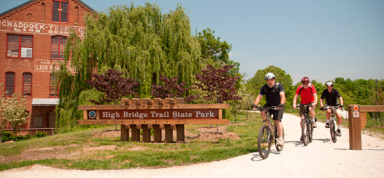
High Bridge Trail State Park
1466 Camp Paradise Road, Rice, VA 23966; Phone: 434-480-5835; Email: highbridgetrail@dcr.virginia.gov
Latitude, 37.304488. Longitude, -78.390938.


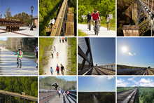
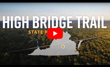
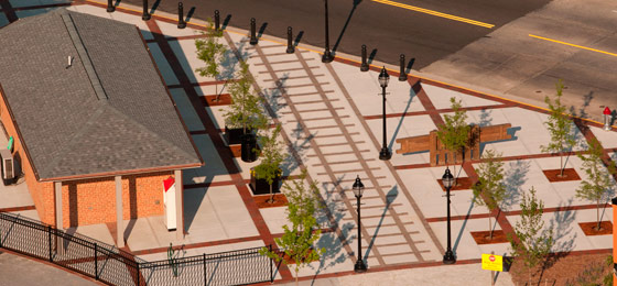
Photos and video

This content takes priority over any other information provided on this park's webpage.
The park is open sunrise to dusk.
River Road and Camp Paradise parking lots open at 8 a.m. All other parking lots open at sunrise.
The High Bridge Visitor Center and gift shop is open daily, 9 a.m. to 4 p.m.
All restroom facilities are open.
Please review the Virginia State Parks Know Before You Go information before you visit.
General Information
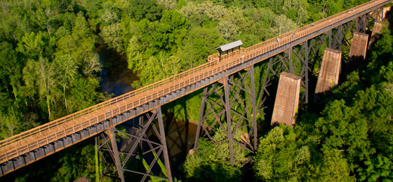
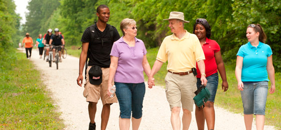
High Bridge Trail is 32.2 miles long and ideally suited for hiking, bicycling and horseback riding. Once a rail bed, the trail is wide, level and generally flat. Its finely crushed limestone surface and dimensions make it easy to enjoy. The park’s centerpiece is the majestic High Bridge, which is more than 2,400 feet long and 125 feet above the Appomattox River. It is the longest recreational bridge in Virginia and among the longest in the United States. High Bridge, a Virginia Historic Landmark, is on the National Register of Historic Places. The trail is a National Recreation Trail recognizing exemplary trails of local and regional significance, connecting people to nature, to each other, and to our shared history and culture. Bring drinking water because none is available on the trail.
High Bridge access
There are two parking lots near High Bridge.
East of the bridge: 1466 Camp Paradise Road; Rice, Virginia (Prince Edward County)
- Use 1681 Aspen Hill Road Rice, Virginia 23966, to get to the entrance of Camp Paradise Road then travel 1.5 miles to the parking area.
- High Bridge is .3 miles from the High Bridge Station parking lot. There is trailer parking just before the main parking lot, .6 miles east of High Bridge.
West of the bridge: River Road, Farmville (Cumberland County)
- Use 555 River Road, Farmville, VA 23901, to get here. High Bridge is nearly a mile from the lot. Trailers are not allowed at this lot.
Trip suggestions
- Bikers might prefer parking at the Rice parking lot, which is 3.2 miles from the bridge and 8.2 miles from Farmville. Bikers might also wish to park at the Main Street Plaza parking lot in Farmville; the bridge is 4.5 miles from that lot.
- For equestrians, the designated horse trailer parking lots are at Camp Paradise Road. (.6 miles from the bridge) and Prospect (14.1 miles from the bridge).
Hours
Dawn - dusk.
Location
High Bridge Trail traverses Cumberland, Nottoway and Prince Edward Counties and the towns of Burkeville, Farmville, Pamplin City, Prospect and Rice. The address listed above is for mail.
Entrances - Parking availability:
- Rice - 642 Rice's Depot Road, 1/4-mile off U.S. 460 at Rice, near trail milepost 3.5E*
- High Bridge Station - 1466 Camp Paradise Road, Rice; 3.2 miles off 460/Aspen Hill Road in Rice, near trail milepost 0.5E*
- River Road - 555 River Road, 3 miles off N. Main Street in Farmville, near trail milepost 1W*
- Municipal lots in Farmville where the trail intersects with Main Street near trail milepost 4.5W
- Tuggle - 4525 Hardtimes Road, Prospect; off U.S. 460 and near U.S. 15 North, near trail milepost 10.5W*
- Prospect - 187 Prospect Road, off U.S. 460 at Prospect, near trail milepost 13W*
- Elam - Off U.S. 460 at Sulphur Springs Road near trail milepost 18W*
- Pamplin – Off U.S. 460 on 1779 Pamplin Road at trail milepost 21.9W*
* Pay lots. You may use cash, check, Visa, MasterCard, Discover, or American Express at self-pay lots.
Restroom Facilities:
- Piney Grove – Vault Toilet – Mile Marker 6.5 E – Located .9 miles west from Moran Road.
- Rice – Vault Toilet – Mile Marker 3.5 E – Located on the east side of the parking lot.
- High Bridge Station – Vault Toilet and Flush Toilets – near Mile Marker .5 E – Located at the Camp Paradise parking lot.
- River Road – Vault Toilet – Mile Marker 1.0 W – Located down the path, behind the electric substation.
- Main Street, Downtown Farmville – Flush Toilets (owned and maintained by the Town of Farmville) – Located on the High Bridge Plaza.
- Tuggle – Vault Toilet – Mile Marker 10.5 W – Located just east of the Tuggle parking lot.
- Prospect – Vault Toilet –Mile Marker 14.0 W – Located on the east side of the Prospect parking lot.
- Heights School – Vault Toilet – Mile Marker 20.5 W
- Pamplin – Portajohn – Mile Marker 21.9 W – Located at the parking lot at 1779 Pamplin Road.
Park Size
1,291 acres.
Follow us

Cabins, camping
OVERNIGHT FACILITIES
None. For information on the availability of other parks' overnight accommodations, particular park amenities or to make a reservation, you can reserve online or call 1-800-933-PARK. Click here for park fees.
Cabins
None in the park, but nearby Bear Creek Lake and Twin Lakes state parks have cabins.
Camping
None in the park, but nearby Bear Creek Lake, Holliday Lake and Twin Lakes state parks have camping.
Recreation
TRAILS
The linear park has more than a total of 40 miles of hiking, bicycle and bridle trails. High Bridge Trail, a recognized National Recreation Trail, itself is 31 miles long, and numerous additional biking and hiking trails adjacent to it.
Click here for information about trail etiquette.
Hiking - Camp Paradise, Smyth, Spur Line and Spur Line Connector trails offer a variety of unique hiking experiences and are directly accessible from High Bridge Trail with easy to moderate difficulty.
Biking - Burnside, Deering and Early trails total 5.5 miles and offer fun and challenging single-track mountain biking. The Smyth Trail allows biking and hiking. Here's a map of those trails.
SWIMMING
None at this park.
FISHING, BOATING
High Bridge Trail parallels and crosses over sections of the Appomattox River. In addition to largemouth and smallmouth bass, the Appomattox is home to the Kentucky spotted bass and numerous other freshwater species. Access to the river is limited. Nearby Twin Lakes and Holliday Lake state parks offer other fishing and overnight accommodations.
HORSES
Bridle trail. State law requires that visitors carry a copy of a negative Coggins report with each horse brought to the park. Horses must be dismounted and led across bridges.
Park Trail Guide
Click here for the park's trail guide.
Download (external link for use with Avenza App) the geo-referenced map
Download the geo-referenced map for this park
Nearby Attractions
Bear Creek Lake State Park, Holliday Lake State Park, Sailor’s Creek Battlefield Historical State Park, Twin Lakes State Park, Sandy River Reservoir, the Adventure Park at Sandy River Retreat (zip lines, canopy rope courses), the Outdoor Adventure Store, Briery Creek Wildlife Management Area, Prince Edward-Gallion State Forest, Lee’s Retreat Driving Tour, the Museum of the Confederacy in Appomattox, Va., Longwood University Visual Arts Center, Robert Russa Moton Museum, Old Town Farmville, Farmville, Prince Edward County, Cumberland County, Nottoway County
Picnic Shelters
None, but there's a large picnic area at Camp Paradise, and there are picnic tables along the main trail.
Meeting Space and Facilities
MEETING FACILITIES
None at this park.
VISITOR CENTER, GIFT SHOP
High Bridge Station Visitor Center and gift shop is located at 1466 Camp Paradise Road near High Bridge.
RESTAURANT
None at this park, but Farmville has many restaurants near the trail.
LAUNDRY
None at this park.
ENVIRONMENTAL EDUCATION CENTER
None at this park.
Other Info
ACCESSIBILITY
The trail and parking lots are accessible. Lots at Camp Paradise, Elam, Prospect, River Road and Tuggle have handicapped parking spots. Vault toilets and bathrooms in Farmville are accessible.
Rangers at the park offer accessibility tours throughout the year to help disabled persons access High Bridge. Reservations are required. Call 434-315-0457 or email highbridgetrail@dcr.virginia.gov.
NATURE, HISTORY PROGRAMS
The park offers year-round self-guided experiences as well as unique historical and environmental education programming. Call 434-315-0457 or email highbridgetrail@dcr.virginia.gov to schedule a field trip or private program for your group.
Click here to view all parks' events, festivals, workshops and interpretive programs.
CONCESSIONS
Gift Shop on the Go at the Camp Paradise parking lot is open Friday to Sunday from April through November, weather permitting. Bottled water, T-shirts, hiking medallions and other memorabilia are sold there.
HISTORY
In December 2006, Norfolk Southern Railway Co. donated a 31-mile tract of abandoned railroad to the state for the establishment of a new state park. The rail line was part of the Petersburg to Lynchburg line. On Aug. 22, 2008, four miles of the linear park were opened to the public. On June 6, 2009, another 10 miles were opened to the public. Six more miles were opened on Nov. 14, 2009, and another four miles were opened on July 3, 2010. On Sept. 4, 2010, the trail's final six miles were opened. After 13 months of rehabilitation work, High Bridge was opened to the public on April 6, 2012. Its completion provides the final link in the 31-mile trail.
FRIENDS GROUP
Feel like lending nature a hand? The Friends of High Bridge Trail State Park is a group of hands-on volunteers dedicated to preserving the park and supporting its mission. Call 434-315-0457 or email fofhbt@gmail.com for more information.
MASTER PLAN
Master plans must be written for parks before they're built. The plans are updated at least once every 10 years thereafter. The plans cover the size, types, infrastructure and locations of facilities as well as the site's special features and resources. Three public meetings are held during the initial development of each plan. Click here for this park's master plan. Click here for this park's master plan details.
Events, Programs
- 04/21/2026 - Vernal Pool Exploration with Master Naturalists
- 04/25/2026 - "Restore Our Earth" Wild Bird Survey
- 04/25/2026 - Crewe Astronomy Club
- 05/02/2026 - Know & Love Our Watershed
- 05/16/2026 - National Kids to Parks Day
- More events at this park.

Blogs
- The Importance of Vernal Pools
- Trail etiquette on Virginia State Parks' rails-to-trails
- New trail to explore at High Bridge Trail State Park
- Holiday shopping at Virginia State Parks
- Seven September adventures
- More blogs about this park.
At a Glance


