Virginia Department of Conservation and RecreationAn official website of the Commonwealth of Virginia Here's how you knowAn official websiteHere's how you know
 Department of Conservation and Recreation


If you are willing to fill out a quick survey about your use of this and other Virginia ConservationVision models, please click here. This will also enable you to sign up for notifications about model updates.
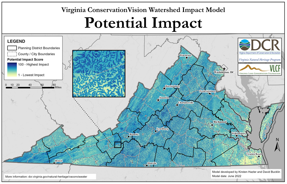
The purpose of the Virginia ConservationVision Watershed Impact Model is to help establish geographic priorities for conservation, restoration, or implementation of best management practices, where the goal is to maintain or improve water quality and/or aquatic ecological integrity. It is intended as a geospatial screening tool for assessing where activities on the land are expected to have the greatest impact on water. The model relies on multiple data sources representing conditions that drive the terrestrial influence on aquatic systems, including precipitation, geology, soils, topography, and hydrology. Although land cover also exerts a key influence on hydrologic flow and pollutant loads reaching streams, it is not used to calculate potential impact. Instead, potential impact is calculated under a "worst case scenario" assumption of barren land. By leaving land cover out of the equation, the calculation of potential impact is robust in the face of land cover changes that can happen over very short time scales.
In addition to the model's primary raster output representing potential impact, scored from 1 to 100, we provide several intermediate raster outputs that can be combined in various ways depending on end users' needs. These include scores based on:
This model is a contribution to the digital conservation planning atlas known as Virginia ConservationVision. It can be used in conjunction with other data to help prioritize conservation, restoration, and management efforts geared toward maintaining and/or improving the ecological health of aquatic systems and the quality of drinking water sources in Virginia.
For an overview of how this model was produced and how it can be applied, two slide presentations are available:
For details, refer to the technical report (PDF), which includes:.
An interactive web map, including the primary model output and intermediate products, is available on ArcGIS Online. The primary output is also available on Natural Heritage Data Explorer in the "Conservation Planning" section.
If you need more information, please contact Shiva.Torabian@dcr.virginia.gov, phone: 804-225-2820.